Watch Duty Adds Flood Tracking Feature in the U.S.
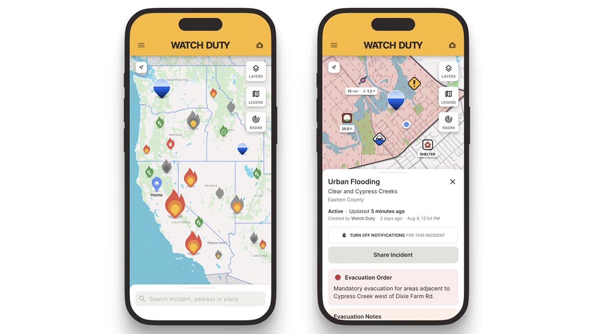
Photo: Android Authority
Quick answer
Watch Duty has added flood tracking functionality in the U.S., combining official data sources into a user-friendly format.
Watch Duty, an independent app previously focused on wildfire alerts, now supports flood monitoring across the U.S. Developers have integrated data from official sources, including the National Weather Service (NWS), the Federal Emergency Management Agency (FEMA), and the National Oceanic and Atmospheric Administration (NOAA).
The new feature consolidates flood warnings, precipitation data, and river gauge readings into a single interface. Data is presented in a simple format using a map, where hazardous zones are marked with blue icons. The app covers various types of floods, as well as risks associated with dam breaches or bridge collapses.
Watch Duty leverages a network of reporters, including former first responders, emergency services personnel, and dispatchers. They verify information on-site and confirm data before publishing it in the app. Users can customize personal alerts for river water level thresholds—the free version supports one sensor, while the paid version allows multiple.
Flood tracking is now available to all Watch Duty users in the U.S. The app can be installed via Google Play Store, Apple App Store, or accessed through a browser.
Common questions
- What data does Watch Duty use for flood tracking?
- The app aggregates information from the National Weather Service, FEMA, NOAA, and other agencies, including warnings, precipitation data, and river levels.
- Can users customize alerts in Watch Duty?
- Yes, users can set threshold values for water levels in rivers. The free version allows monitoring one sensor, while the paid version supports multiple.
- Where is Watch Duty available?
- The app is available for download on Google Play Store and Apple App Store, and it also works in browsers across the U.S.
Dzen feed: /feed/dzen.xml · RSS: /feed.xml